In an era where natural disasters are becoming more frequent and severe due to climate change, deploying innovative technologies is critical in enhancing the effectiveness of disaster response and recovery efforts. One of the most transformative technologies in this field is Mobile LiDAR scanners. These sophisticated devices are revolutionizing how first responders and recovery teams manage emergencies and rehabilitate environments post-disaster.
What are Mobile LiDAR Scanners?
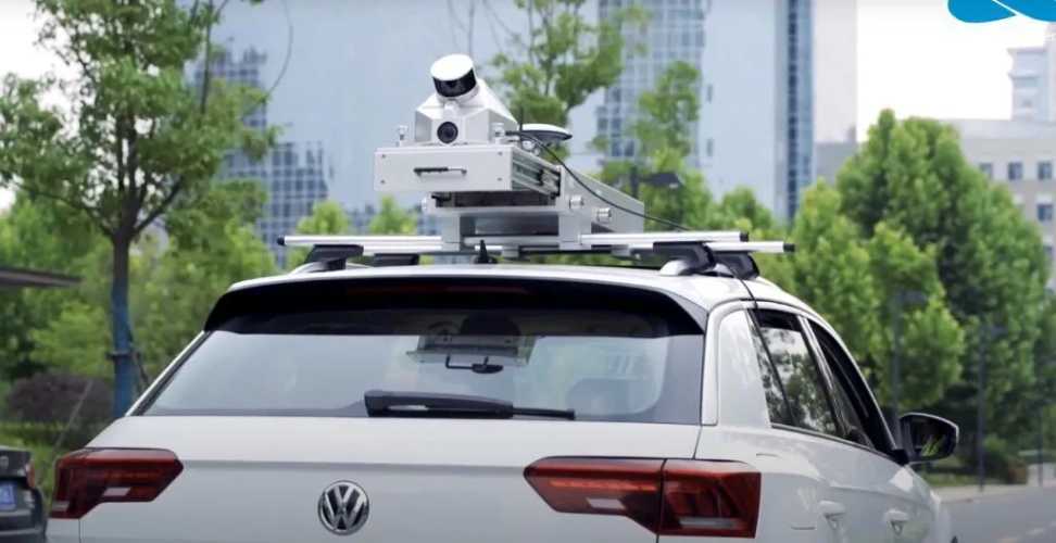
Mobile LiDAR scanners are advanced remote sensing systems that use laser light to measure distances to the Earth’s surface. Mounted on moving vehicles like cars, drones, or airplanes, these systems capture high-resolution, three-dimensional information about an area’s shape and surface characteristics. Unlike traditional static LiDAR, which requires setting up equipment on tripods, mobile LiDAR offers the flexibility and speed needed in urgent disaster scenarios.
Rapid Disaster Assessment and Response
The initial phase after any disaster is critical. A quick and accurate assessment is essential for effective response and to minimize further risk to human life. Mobile LiDAR scanners play a crucial role during this phase. They can be deployed immediately following a disaster to collect detailed geographic data that helps responders understand the extent of damage and navigate obstructed routes.
For instance, in the aftermath of an earthquake, buildings may be damaged and roads blocked. Mobile LiDAR scanners mounted on drones can quickly fly over the affected areas, providing first responders with detailed 3D maps. These maps are instrumental in identifying safe routes for rescue teams and in assessing structural damage to buildings, bridges, and other infrastructure.
Enhancing Search and Rescue Operations
Search and rescue operations are among the most challenging tasks following earthquakes, floods, or landslides. Mobile LiDAR technology enhances these operations by allowing rescue teams to create real-time maps of difficult terrain. For example, in forest fires or landslides where the landscape changes rapidly, mobile LiDAR-equipped drones can provide up-to-date data that is crucial for locating survivors and planning rescue paths.
Moreover, the ability of LiDAR to penetrate vegetation can be invaluable in detecting people or objects hidden under foliage, which is particularly useful in areas with dense forests. This capability significantly increases the chances of finding and rescuing survivors in less accessible areas.
Streamlining Debris Management
Post-disaster recovery involves clearing debris, a task that can be overwhelming due to the scale and distribution of rubble. Mobile LiDAR scanners help by quickly assessing the volume and location of debris, facilitating efficient planning and removal. This data ensures that heavy equipment and personnel are deployed effectively, speeding up the clearing process while ensuring safety.
Additionally, by analyzing before and after scans, teams can track progress and update strategies in real-time, greatly improving the management of such complex operations.
Supporting Reconstruction Efforts
The focus shifts to reconstruction once immediate rescue and clearing operations are over. Here again, mobile LiDAR scanners prove invaluable. The detailed 3D models these scanners generate provide a precise basis for rebuilding efforts. They help engineers and planners redesign infrastructure by providing accurate data on the topography and remaining structures, ensuring that new constructions are better suited to withstand future disasters.
These 3D models also help preserve historical accuracy when reconstructing heritage sites damaged by disasters, ensuring that rebuilding efforts maintain cultural integrity.
Reducing Future Risks
Mobile LiDAR scanners aid in immediate response and recovery and in mitigating future disasters. Scientists and disaster management experts can study how landscapes and buildings respond to different disaster scenarios by analyzing the data collected. This research is crucial in improving building codes, developing better land use policies, and designing infrastructure that is more resilient to the types of disasters specific to an area.
Conclusion
Mobile LiDAR scanners are transforming the landscape of disaster management. Their ability to rapidly collect detailed and accurate geographical data makes them a crucial tool in the arsenal of disaster response teams. Whether it’s through facilitating rapid assessment and effective debris removal or enhancing rescue operations and supporting reconstruction efforts, these advanced systems play a pivotal role in responding to disasters and preparing for future challenges.
Deploying mobile LiDAR technology in disaster-prone areas represents a proactive approach to disaster management. It invests in safety, resilience, and recovery capacity to save lives, preserve communities, and accelerate recovery times. As technology advances and becomes more integrated into disaster response strategies, its impact on saving lives and rebuilding communities will grow, solidifying its role as a critical tool in modern disaster response and recovery efforts.
Author Bio:
Natasha is a blogger and technical writer. She has worked with different companies and has 11 years of experience in content writing, SEO, and digital marketing. She is the owner of SoftwareTestingLead.
Have A Look :-
- How To Check Warranty Of Lenovo Laptop Or Desktop?
- The Intersection of Robotics and Healthcare: Advancements in Surgery
- What Is Yimusanfendi? Exploring The Best Data Gathering Tool For Information